Géoportail de la Wallonie
The Géoportail de la Wallonie is the Service public de Wallonie (SPW) site for Walloon geographic information: it runs the WalOnMap viewer, the Metawal metadata catalogue (exposed as an OGC CSW 2.0.2 service), a published list of 889 web services (OGC WMS, ESRI ArcGIS REST and OGC API - Features endpoints, several on geoservices.wallonie.be), the API Geoviewer JavaScript embedding library, and the regional INSPIRE implementation.
Géoportail de la Wallonie is listed with 4 APIs on the APIs.io network. Tagged areas include Company, Government, Geospatial, OGC, and INSPIRE.
Géoportail de la Wallonie’s developer surface includes pricing, documentation, support, FAQ, signup flow, engineering blog, and 4 more developer resources.
Kin Score
 Kin Score
How this is scored →
scored 2026-11-13 · rubric v0.28.0
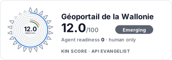 It updates itself when the score changes. Paste this where you link to your API docs:
<a href="https://apis.io/providers/wallonie-be/"><img src="https://apis.io/badge/wallonie-be/card.svg" alt="Géoportail de la Wallonie on APIs.io — Kin Score by API Evangelist"></a>Other styles, a README pill and a shields.io endpoint are on the badge page.
- Machine-Readable Contract +18 pts — api_specs includes an OpenAPI document Ask about this →
- MCP Server +12 pts — deployment.mode + probe verdict on the mcp/ manifest, not the pointer; an unprobed slug falls back to authorship Ask about this →
- Agentic Access Contract +10 pts — agentic_access artifact present (x-agentic-access), graded by author Ask about this →
- Machine-Readable Auth +10 pts — a served openid-configuration/oauth-authorization-server carrying `issuer` (served), else the securitySchemes class in the provider OpenAPIs — bound (mutualTLS, DPoP, Signature) > negotiable (oauth2 authorizationCode/clientCredentials, openIdConnect) > bearer (http bearer, apiKey) Ask about this →
- Idempotency +9 pts — OpenAPI mutating operations declare an idempotency key — a header, a request-body property, or a named de-duplication token whose own description says so (verified); else common[].type matches /idempoten/i (documented) Ask about this →
- Stable Error Semantics +8 pts — OpenAPI $refs a shared error schema across 4xx/5xx responses (verified), else common[].type includes ErrorCatalog / ErrorCodes / DeclineCodes Ask about this →
- Contract Quality scores 0.0 — up to +25.0 composite points Ask about this →
- Developer Ergonomics scores 16.7 — up to +16.7 composite points Ask about this →
- Access Clarity scores 19.1 — up to +16.2 composite points Ask about this →
APIs 4
Individual APIs this provider publishes, each with its own machine-readable definition.
Metawal CSW Catalogue Service
OGC Catalogue Service for the Web (CSW 2.0.2) exposing Metawal, the catalogue of metadata about Walloon geographic resources, used by the Géoportail catalogues and the European ...
SPW Geoservices (ArcGIS REST and WMS)
ESRI ArcGIS Server REST map services and OGC WMS endpoints of the Service public de Wallonie on geoservices.wallonie.be, listed on the Géoportail web services page.
High Value Datasets OGC API - Features
OGC API - Features services (SIGEC agricultural parcels, inland navigation, noise, protected sites) listed on the Géoportail web services page under geoservices.test.wallonie.be...
API Geoviewer du SPW
JavaScript library from the SPW for embedding Walloon interactive maps in third-party web pages.
Security Posture 1
Authentication, domain security, vulnerability disclosure, and trust-center signals.
Resources
Get Started 1
Portal, sign-up, and the first successful call
Documentation 1
Reference material describing how the API behaves
Access & Security 1
Authentication, authorization, and security posture
Operate 2
Status, limits, changes, and where to get help
Commercial 1
Pricing, plans, and the legal terms of use
Company 2
The organization behind the API
Other 2
Properties that don't map to a standard resource type
Source (apis.yml)
Géoportail de la Wallonie API — frequently asked questions
Does Géoportail de la Wallonie have an API?
Yes. APIs.io lists 4 APIs from Géoportail de la Wallonie, including Metawal CSW Catalogue Service, SPW Geoservices (ArcGIS REST and WMS) and High Value Datasets OGC API - Features, and 1 more.
Is the Géoportail de la Wallonie API ready for AI agents?
Géoportail de la Wallonie has a Kin Score of 12.0 out of 100 (emerging) and an Agent Readiness score of 0.0 (human-only), scored by API Evangelist on 2026-11-13.
Work with this as data
Every provider here is available over the APIs.io API and to AI agents over MCP.