
Searoutes
Searoutes is a maritime routing and carbon-emissions API platform for logistics, freight forwarding, and supply-chain teams. Its REST APIs compute point-to-point, port-to-point, and port-to-port sea routes with distances and durations (including SECA, HRA, and ice-area avoidance), geocode ports, airports, and places, calculate multimodal CO2e emissions (sea, road, rail, air, inland waterway) using a GLEC-accredited methodology, track vessels via AIS (positions, ETAs, traces, arrivals), look up carriers and services, and return historical, real-time, and forecasted weather along routes. All APIs are served from https://api.searoutes.com and authenticated with an x-api-key header.
Searoutes publishes 6 API contracts indexed on the APIs.io network, including CO2 Emissions API, Geocoding API, Ocean Routing API, and 3 more. Tagged areas include Maritime, Sea Routing, Ocean Freight, CO2 Emissions, and Carbon Accounting.
Searoutes’ developer surface includes authentication, documentation, engineering blog, and 9 more developer resources.
What this lets a business do 1
Business capabilities this provider's published APIs can perform, derived from its own contracts. Browse all capabilities →
Kin Score
 Kin Score
How this is scored →
Kin Score
How this is scored →scored 2026-10-23 · rubric v0.25.0
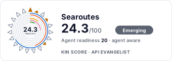 It updates itself when the score changes. Paste this where you link to your API docs:
<a href="https://apis.io/providers/searoutes/"><img src="https://apis.io/badge/searoutes/card.svg" alt="Searoutes on APIs.io — Kin Score by API Evangelist"></a>Other styles, a README pill and a shields.io endpoint are on the badge page.
Markets this provider is in provisional
The Kin Score Market layer reads a provider inside its market: its position, and how deep its integrations go. Depth is only comparable within a position. Provisional and unweighted: not part of the Kin Score or agent readiness.
| Market | Position | Depth | Registered MCP server | Declares compatibility |
|---|---|---|---|---|
| Maritime Logistics (ocean shipping, eBL, ports) | undeclared | - | - | - |
Registered MCP server and declares compatibility are report only — not weighted. Undeclared means we found nothing we can read, so there is no number: we never infer integrations.
Standards implemented 1
Standards this provider implements or carries. De facto ones are profiled and measured by the API Commons; formal ones come from the standards directory and are linked by the provider's own tags. The evidence column says how each claim was established — not that it was made.
APIs 6
Individual APIs this provider publishes, each with its own machine-readable definition.
Searoutes CO2 Emissions API
Multimodal CO2e emission calculations (sea, road, rail, air, inland water).
Searoutes Geocoding API
Ports, airports, places, areas, postal codes, and nearest points.
Searoutes Ocean Routing API
Sea routes, distances, durations, and voyage plans.
Searoutes Search API
Carrier and liner-service lookup.
Searoutes Vessel API
AIS vessel positions, ETAs, arrivals, traces, and time series.
Searoutes Weather API
Historical, real-time, and forecasted weather.
Open Collections 7
Open, tool-agnostic API collections (OpenAPI-derived and Bruno).
Searoutes CO2 Emissions API
OPEN COLLECTIONSearoutes CO2 Emissions Geocoding API
OPEN COLLECTIONSearoutes CO2 Emissions Ocean Routing API
OPEN COLLECTIONSearoutes CO2 Emissions Search API
OPEN COLLECTIONSearoutes CO2 Emissions Vessel API
OPEN COLLECTIONSearoutes CO2 Emissions Weather API
OPEN COLLECTIONSearoutes API
OPEN COLLECTIONScroll for all 7
Pricing Plans 1
Published pricing tiers and plan structures.
Rate Limits 1
Documented rate limits and quota policies.
Searoutes Rate Limits
RATE LIMITSFinOps 1
Cost, billing, and metering signals for API financial operations.
Searoutes Finops
FINOPSSecurity Posture 2
Authentication, domain security, vulnerability disclosure, and trust-center signals.
Agentic Access 1
Recommended x-agentic-access execution contracts for AI agents.
Resources
Documentation 1
Reference material describing how the API behaves
Agent Surfaces 1
MCP servers, agent skills, and machine-readable catalogs
Build 1
SDKs, sample code, and the tooling you integrate with
Access & Security 2
Authentication, authorization, and security posture
Operate 1
Status, limits, changes, and where to get help
Commercial 2
Pricing, plans, and the legal terms of use
Company 3
The organization behind the API
Other 1
Properties that don't map to a standard resource type
Source (apis.yml)
Work with this as data
Every provider here is available over the APIs.io API and to AI agents over MCP.