
Propeller Aero
Propeller Aero is a drone survey and earthworks analytics platform for construction, mining, aggregates, and waste sites. Teams fly a drone, process imagery with Propeller's AeroPoints ground control and photogrammetry pipeline, and get accurate 3D site surveys, terrain models, volumes, and progress tracking in the Propeller Platform. The Propeller Public API is a paid, premium feature (available on higher tiers such as Scale) that gives programmatic, read-oriented access to organizations, sites, workspaces, surveys, downloadable survey files (orthophotos, terrain, point clouds), user-defined shapes and their calculated widgets (volumes, distances, areas), and DirtMate position-monitoring data. It is a REST API over HTTPS authenticated with a Bearer access token or via OpenID Connect.
Propeller Aero publishes 7 API contracts indexed on the APIs.io network, including Organizations API, Position Monitoring API, Shapes API, and 4 more. Tagged areas include Drone Survey, Geospatial, Earthworks, Construction, and Mining.
Propeller Aero’s developer surface includes authentication, documentation, API reference, support, engineering blog, and 9 more developer resources.
Kin Score
 Kin Score
How this is scored →
Kin Score
How this is scored →scored 2026-10-23 · rubric v0.25.0
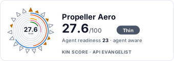 It updates itself when the score changes. Paste this where you link to your API docs:
<a href="https://apis.io/providers/propeller-aero/"><img src="https://apis.io/badge/propeller-aero/card.svg" alt="Propeller Aero on APIs.io — Kin Score by API Evangelist"></a>Other styles, a README pill and a shields.io endpoint are on the badge page.
Markets this provider is in provisional
The Kin Score Market layer reads a provider inside its market: its position, and how deep its integrations go. Depth is only comparable within a position. Provisional and unweighted: not part of the Kin Score or agent readiness.
| Market | Position | Depth | Registered MCP server | Declares compatibility |
|---|---|---|---|---|
| Carbon Markets and Environmental Services (carbon removal, waste, mining) | undeclared | - | - | 1 |
| XR & Graphics (XR, 3D, GPU graphics) | undeclared | - | - | 1 |
| Energy Subsurface (oil & gas data standards, mining) | undeclared | - | - | 1 |
Registered MCP server and declares compatibility are report only — not weighted. Undeclared means we found nothing we can read, so there is no number: we never infer integrations.
APIs 7
Individual APIs this provider publishes, each with its own machine-readable definition.
Propeller Aero Organizations API
Top-level accounts that own sites, workspaces, and surveys.
Propeller Aero Position Monitoring API
DirtMate position-monitoring configs and recorded epochs.
Propeller Aero Shapes API
User-defined polygons, lines, and points drawn in a workspace.
Propeller Aero Sites API
Survey projects (job sites) within an organization.
Propeller Aero Surveys API
Individual drone survey captures and their downloadable files.
Propeller Aero Widgets API
Calculated measurements (volumes, distances, areas) tied to a shape.
Propeller Aero Workspaces API
Analysis contexts within a site that hold shapes and widgets.
Scroll for all 7
Open Collections 7
Open, tool-agnostic API collections (OpenAPI-derived and Bruno).
Propeller Public Organizations API
OPEN COLLECTIONPropeller Public Organizations Position Monitoring API
OPEN COLLECTIONPropeller Public Organizations Shapes API
OPEN COLLECTIONPropeller Public Organizations Sites API
OPEN COLLECTIONPropeller Public Organizations Surveys API
OPEN COLLECTIONPropeller Public Organizations Widgets API
OPEN COLLECTIONPropeller Public Organizations Workspaces API
OPEN COLLECTIONScroll for all 7
Pricing Plans 1
Published pricing tiers and plan structures.
Rate Limits 1
Documented rate limits and quota policies.
Propeller Aero Rate Limits
RATE LIMITSFinOps 1
Cost, billing, and metering signals for API financial operations.
Propeller Aero Finops
FINOPSSecurity Posture 3
Authentication, domain security, vulnerability disclosure, and trust-center signals.
Agentic Access 1
Recommended x-agentic-access execution contracts for AI agents.
Resources
Documentation 2
Reference material describing how the API behaves
Agent Surfaces 1
MCP servers, agent skills, and machine-readable catalogs
Build 1
SDKs, sample code, and the tooling you integrate with
Access & Security 3
Authentication, authorization, and security posture
Operate 2
Status, limits, changes, and where to get help
Commercial 2
Pricing, plans, and the legal terms of use
Company 3
The organization behind the API
Source (apis.yml)
Work with this as data
Every provider here is available over the APIs.io API and to AI agents over MCP.