Cropio was an independent Eastern European farm management and precision agriculture platform (fields, satellite/NDVI imagery, weather, scouting, machinery telematics, and yield) founded in 2013. Syngenta acquired Cropio in September 2019 and folded it into its Cropwise digital agriculture portfolio; the product now operates as Cropwise Operations, and cropio.com redirects to operations.cropwise.com. The original Cropio API v3 was not shut down - it continues to run as the documented Cropwise Operations Platform API v3, reachable at operations.cropwise.com/api/v3 (the legacy cropio.com/api/v3 host has redirected there since April 1, 2022). It is a per-account HTTP JSON REST API (not a self-serve developer marketplace) - a Cropwise Operations login is required to obtain a USER_API_TOKEN, and there is no published self-signup API key flow or API-specific price list. Syngenta separately launched a broader "Cropwise Open Platform" for partners in 2025, which is a distinct, newer developer program outside the scope of this entry.
Cropio is listed with 7 APIs on the APIs.io network. Tagged areas include Agriculture, AgTech, Precision Agriculture, Farm Management, and Satellite Imagery.
Cropio’s developer surface includes documentation and 7 more developer resources.
Regulatory Posture applies to this provider. Its tags matched the
Horizontal (data, software, accessibility, platform) regime, so
Regulatory Posture carries 15 points of the composite.
If this regime is wrong for your business, say so on your
provider repo — the
applicability map is public and we will correct it.
Create-or-Update Ergonomics could not be measured. We hold no machine-readable contract for
this provider to read, so there is nothing to measure a write surface against. Excluded rather than scored zero:
never-measured and measured-empty are different facts. Publishing an OpenAPI is what makes this facet — and
several others — scorable at all.
The six quality facets above are damped to 85 points between them,
because the conditional facet above carries the other
15. That is why each facet's contribution is shown against a damped
maximum: raising a quality facet moves the composite by 85% of its nominal
weight, not 100%. The full arithmetic is at apis.io/rating/.
Show this score on your site.
It updates itself when the score changes. Paste this where you link to your API docs:
<a href="https://apis.io/providers/cropio/"><img src="https://apis.io/badge/cropio/card.svg" alt="Cropio on APIs.io — Kin Score by API Evangelist"></a>
Other styles, a README pill and a shields.io endpoint are on the badge page.
Improve this rating by publishing the missing artifacts — every area above can be raised, and the full rubric is at apis.io/rating/. Every facet and dimension name above is a link: it opens that measurement's own page — what it means, the exact checks that feed it, how the whole catalog distributes on it, and the providers at the top of it. This rating is computed from github.com/api-evangelist/cropio: open an issue to ask a question, or submit a pull request to add artifacts.
Submit an artifact on GitHub — free →Manage your own listing — the Influence plan, $499/mo →
Markets this provider is in provisional
The Kin Score Market layer reads a provider inside its market:
its position, and how deep its integrations go. Depth is only comparable within a position. Provisional and unweighted:
not part of the Kin Score or agent readiness.
Registered MCP server and declares compatibility are report only — not weighted.
Undeclared means we found nothing we can read, so there is no number: we never infer integrations.
Create, list, get, update, and delete fields, field groups, field shapes (boundaries in multiple geo formats), and land parcels. Fields carry calculated/legal/tillable area, adm...
Manage crops (name, season type, base crop, color scheme), seasons (year, start/end date), production cycles, and growth stage / growth scale tracking used to plan and record wh...
Read-only weather station data (real and virtual stations) keyed by geoposition, including a rolling 24-hour hourly current_weather array (precipitation, air temperature, and re...
Create and manage scouting tasks and manual tasks assigned to a field and a responsible user, plus the field scout reports, scout report points, and plant threat findings record...
Manage machines, implements, and machine tasks (driver, work type, field, start/end time), plus GPS logger data - raw and hourly-aggregated positions, speed, and distance per ma...
Read and write yield maps (per-field moisture/yield/applied property maps tied to a field work result), harvest weighings and transportations, and productivity/yield estimates a...
aid: cropio
url: https://raw.githubusercontent.com/api-evangelist/cropio/refs/heads/main/apis.yml
name: Cropio
kind: company
description: Cropio was an independent Eastern European farm management and precision agriculture platform (fields, satellite/NDVI
  imagery, weather, scouting, machinery telematics, and yield) founded in 2013. Syngenta acquired Cropio in September 2019
  and folded it into its Cropwise digital agriculture portfolio; the product now operates as Cropwise Operations, and cropio.com
  redirects to operations.cropwise.com. The original Cropio API v3 was not shut down - it continues to run as the documented
  Cropwise Operations Platform API v3, reachable at operations.cropwise.com/api/v3 (the legacy cropio.com/api/v3 host has
  redirected there since April 1, 2022). It is a per-account HTTP JSON REST API (not a self-serve developer marketplace) -
  a Cropwise Operations login is required to obtain a USER_API_TOKEN, and there is no published self-signup API key flow or
  API-specific price list. Syngenta separately launched a broader "Cropwise Open Platform" for partners in 2025, which is
  a distinct, newer developer program outside the scope of this entry.
deliveryModel:
  model: saas
  open_source: false
  commercial: true
  callable_host: false
  label: Hosted service · you call their endpoint
  confidence: medium
  source:
  - pricing
  generated: '2026-08-28'
  method: derived
accessModel:
  pricing: freemium
  onboarding: unknown
  trial: true
  try_now: false
  public: false
  label: Freemium (free trial)
  confidence: medium
  source:
  - plans
  generated: '2026-07-22'
  method: derived
image: https://kinlane-images.s3.amazonaws.com/shared/apis-json/icons/cropio.png
x-docs-platform: apiary
x-docs-platform-confidence: high
x-docs-platform-checked: 2026-09-24
tags:
- Agriculture
- AgTech
- Precision Agriculture
- Farm Management
- Satellite Imagery
- NDVI
- Weather
- Telematics
- Syngenta
- Cropwise
created: '2026-07-03'
modified: '2026-07-03'
specificationVersion: '0.23'
apis:
- aid: cropio:cropio-fields-api
  name: Cropio Fields API
  tags:
  - Fields
  - Field Shapes
  - Land Parcels
  image: https://kinlane-images.s3.amazonaws.com/shared/apis-json/apis-json-logo.jpg
  humanURL: https://cropwiseoperations.docs.apiary.io/
  baseURL: https://operations.cropwise.com/api/v3
  properties:
  - url: https://cropwiseoperations.docs.apiary.io/
    type: APIReference
  - url: https://github.com/cropio/cropio-ruby
    type: SDK
  description: Create, list, get, update, and delete fields, field groups, field shapes (boundaries in multiple geo formats),
    and land parcels. Fields carry calculated/legal/tillable area, administrative location, and relations to crops, scouting
    reports, satellite images, and machine tasks.
- aid: cropio:cropio-crops-api
  name: Cropio Crops API
  tags:
  - Crops
  - Seasons
  - Production Cycles
  - Growth Stages
  image: https://kinlane-images.s3.amazonaws.com/shared/apis-json/apis-json-logo.jpg
  humanURL: https://cropwiseoperations.docs.apiary.io/
  baseURL: https://operations.cropwise.com/api/v3
  properties:
  - url: https://cropwiseoperations.docs.apiary.io/
    type: APIReference
  description: Manage crops (name, season type, base crop, color scheme), seasons (year, start/end date), production cycles,
    and growth stage / growth scale tracking used to plan and record what is planted on a field across a season.
- aid: cropio:cropio-satellite-imagery-api
  name: Cropio Satellite Imagery API
  tags:
  - Satellite Imagery
  - NDVI
  - Remote Sensing
  image: https://kinlane-images.s3.amazonaws.com/shared/apis-json/apis-json-logo.jpg
  humanURL: https://cropwiseoperations.docs.apiary.io/
  baseURL: https://operations.cropwise.com/api/v3
  properties:
  - url: https://cropwiseoperations.docs.apiary.io/
    type: APIReference
  description: Read-only access to per-field and per-field-group satellite images - capture date, source satellite, cloud/cirrus/data
    coverage, and min/max/mean NDVI values - plus NDVI grid data for zoning and vegetation-health analysis.
- aid: cropio:cropio-weather-api
  name: Cropio Weather API
  tags:
  - Weather
  - Weather Stations
  - Forecast
  image: https://kinlane-images.s3.amazonaws.com/shared/apis-json/apis-json-logo.jpg
  humanURL: https://cropwiseoperations.docs.apiary.io/
  baseURL: https://operations.cropwise.com/api/v3
  properties:
  - url: https://cropwiseoperations.docs.apiary.io/
    type: APIReference
  description: Read-only weather station data (real and virtual stations) keyed by geoposition, including a rolling 24-hour
    hourly current_weather array (precipitation, air temperature, and related measurements) and historical weather items.
- aid: cropio:cropio-scouting-and-tasks-api
  name: Cropio Scouting & Tasks API
  tags:
  - Scouting
  - Task
  - Field Scout Reports
  - Plant Threats
  tags_raw:
  - Scouting
  - Tasks
  - Field Scout Reports
  - Plant Threats
  image: https://kinlane-images.s3.amazonaws.com/shared/apis-json/apis-json-logo.jpg
  humanURL: https://cropwiseoperations.docs.apiary.io/
  baseURL: https://operations.cropwise.com/api/v3
  properties:
  - url: https://cropwiseoperations.docs.apiary.io/
    type: APIReference
  description: Create and manage scouting tasks and manual tasks assigned to a field and a responsible user, plus the field
    scout reports, scout report points, and plant threat findings recorded against them, and agri-work plans used to schedule
    field operations.
- aid: cropio:cropio-machinery-telematics-api
  name: Cropio Machinery & Telematics API
  tags:
  - Machinery
  - Telematics
  - GPS
  - Machine Tasks
  image: https://kinlane-images.s3.amazonaws.com/shared/apis-json/apis-json-logo.jpg
  humanURL: https://cropwiseoperations.docs.apiary.io/
  baseURL: https://operations.cropwise.com/api/v3
  properties:
  - url: https://cropwiseoperations.docs.apiary.io/
    type: APIReference
  - url: https://github.com/cropio/cropio-powerbi
    type: SDK
  description: Manage machines, implements, and machine tasks (driver, work type, field, start/end time), plus GPS logger
    data - raw and hourly-aggregated positions, speed, and distance per machine - polled over HTTP with a required date/time
    filter. Marked "testing stage" by Cropio in the source docs.
- aid: cropio:cropio-yield-and-harvest-api
  name: Cropio Yield & Harvest API
  tags:
  - Yield
  - Harvest
  - Productivity Estimate
  image: https://kinlane-images.s3.amazonaws.com/shared/apis-json/apis-json-logo.jpg
  humanURL: https://cropwiseoperations.docs.apiary.io/
  baseURL: https://operations.cropwise.com/api/v3
  properties:
  - url: https://cropwiseoperations.docs.apiary.io/
    type: APIReference
  description: Read and write yield maps (per-field moisture/yield/applied property maps tied to a field work result), harvest
    weighings and transportations, and productivity/yield estimates and their history, used to close the loop from field work
    back to harvest results.
common:
- type: DomainSecurity
  url: security/cropio-domain-security.yml
- type: GitHubOrganization
  url: https://github.com/cropio
- type: LinkedIn
  url: https://www.linkedin.com/company/cropio
- type: Website
  url: https://operations.cropwise.com
- type: Documentation
  url: https://cropwiseoperations.docs.apiary.io/
- type: Plans
  url: plans/cropio-plans-pricing.yml
- type: RateLimits
  url: rate-limits/cropio-rate-limits.yml
- type: FinOps
  url: finops/cropio-finops.yml
maintainers:
- FN: Kin Lane
  email: kin@apievangelist.com
x-status: acquired
x-acquired-by: Syngenta
x-acquired-date: 2019-09
x-status-source: https://cropio.com/
x-status-evidence: cropio.com redirects to operations.cropwise.com, Syngenta's Cropwise (probed 2026-10-03); Syngenta is not
  in the catalog (roadmap#814)
Discovery needs no key. Ratings and market analysis are Pro.
Get an API key
Free tier, no form to fill in. Signing in shares your email address with us — we
store it to create your key and to recognise you if you sign in with another
provider. See our Privacy Policy and
Terms.

 Kin Score
How this is scored →
Kin Score
How this is scored →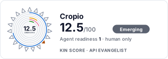 It updates itself when the score changes. Paste this where you link to your API docs: