The Appalachian Regional Commission (ARC) is a federal-state partnership that invests in Appalachia's economic future by funding projects that promote economic development, infrastructure improvement, workforce training, and community development across 423 counties in 13 states. ARC runs no developer program and publishes no API documentation, but it operates two live, anonymous, machine-readable surfaces: the WordPress REST API behind www.arc.gov, which serves its research reports, maps, resources, investment priorities, local development districts, events and staff as JSON; and 108 public hosted feature services in its own ArcGIS Online organization, which carry the region's boundaries and the annual county economic-status, poverty, income, SNAP, broadband, education and population series. Neither needs a key.
Appalachian Regional Commission is listed with 3 APIs on the APIs.io network, including ARC Geospatial API, and 2 more. Tagged areas include Appalachia, Economic Development, Federal Government, Geospatial, and Government.
Appalachian Regional Commission’s developer surface includes documentation, API reference, developer portal, support, engineering blog, YouTube channel, authentication, and 22 more developer resources.
Regulatory Posture applies to this provider. Its tags matched the
Government & Public Sector regime, so
Regulatory Posture carries 15 points of the composite.
If this regime is wrong for your business, say so on your
provider repo — the
applicability map is public and we will correct it.
Create-or-Update Ergonomics does not apply to this provider. The published contracts declare
no write operations, and a read-only API cannot create-or-update. The facet is excluded from this provider's
denominator entirely — not scored zero. A reference or data API is not deficient for being unable to
upsert.
The six quality facets above are damped to 85 points between them,
because the conditional facet above carries the other
15. That is why each facet's contribution is shown against a damped
maximum: raising a quality facet moves the composite by 85% of its nominal
weight, not 100%. The full arithmetic is at apis.io/rating/.
The public WordPress REST API (wp-json) of the Appalachian Regional Commission website at www.arc.gov: the route index of the site's content management system, catalogued as one...
Anonymous query access to the 108 public hosted feature services in the Appalachian Regional Commission's own ArcGIS Online organization (org id nkunl3y8FDxPkXDl, portal arcgov....
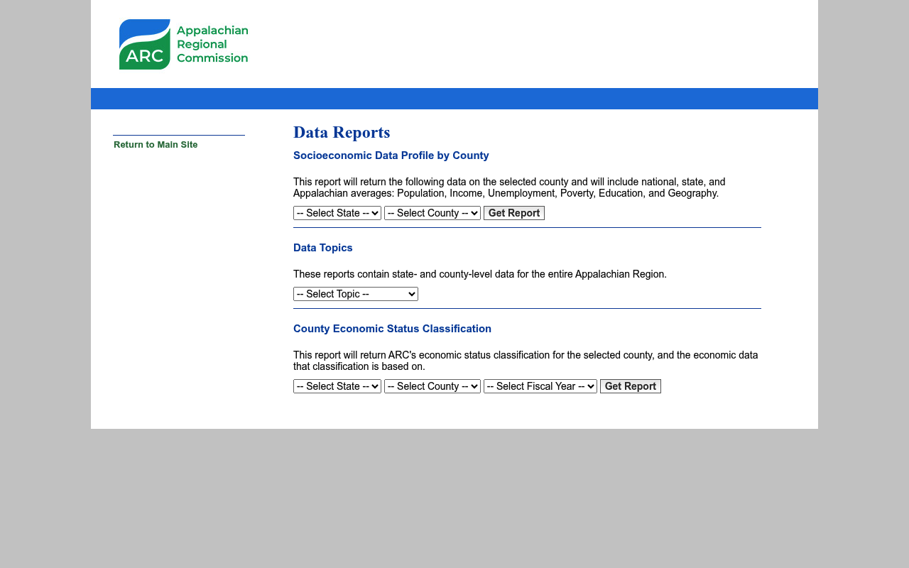
The ARC Data Report Tool provides state- and county-level data for the entire Appalachian Region across six topic areas comparing Appalachian data with national averages. Data c...
State and county-level data reports for all 423 Appalachian counties across six topic areas.
Regional Comparison Data
Appalachian Region data compared against national averages for benchmarking.
Research Reports
Regular research publications addressing socioeconomic issues in the Appalachian Region.
Maps
Geographic mapping data and visualizations covering the Appalachian Region.
Grant Program Data
Data on ARC's investment portfolios, grants, and program evaluations.
Public Feature Services
108 anonymous ArcGIS hosted feature services carrying region, county and district boundaries plus the annual economic-status and ACS statistical series.
Self-Describing Content API
A 371-route WordPress REST index exposing ARC reports, maps, resources, districts, events and staff as JSON with full argument schemas.
Overlays applied on top of this provider's contracts. Each card says who wrote it: a document the provider publishes, or one API Evangelist derived or generated.
aid: appalachian-regional-commission
url: https://raw.githubusercontent.com/api-evangelist/appalachian-regional-commission/refs/heads/main/apis.yml
name: Appalachian Regional Commission
tags:
- Appalachia
- Economic Development
- Federal Government
- Geospatial
- Government
- Infrastructure
- Open Data
- Regional Development
- Workforce Development
tags_raw:
- Appalachia
- Economic Development
- Federal Government
- Geospatial
- Government
- Infrastructure
- Open Data
- Regional Development
- Workforce Development
- Federal-Government
kind: contract
deliveryModel:
  model: open-access
  open_source: false
  commercial: false
  callable_host: true
  label: Open access — anonymous, no key, no signup, no cost
  confidence: high
  source:
  - probe
  generated: '2026-09-07'
  method: probed
accessModel:
  pricing: free
  onboarding: none
  trial: false
  try_now: true
  public: true
  label: Free and open
  confidence: high
  source:
  - plans
  - probe
  generated: '2026-09-07'
  method: probed
image: https://kinlane-images.s3.amazonaws.com/shared/apis-json/icons/appalachian-regional-commission.png
access: 3rd-Party
created: '2024-11-21'
modified: '2026-09-07'
position: Producing
description: 'The Appalachian Regional Commission (ARC) is a federal-state partnership that invests in Appalachia''s economic
  future by funding projects that promote economic development, infrastructure improvement, workforce training, and community
  development across 423 counties in 13 states. ARC runs no developer program and publishes no API documentation, but it operates
  two live, anonymous, machine-readable surfaces: the WordPress REST API behind www.arc.gov, which serves its research reports,
  maps, resources, investment priorities, local development districts, events and staff as JSON; and 108 public hosted feature
  services in its own ArcGIS Online organization, which carry the region''s boundaries and the annual county economic-status,
  poverty, income, SNAP, broadband, education and population series. Neither needs a key.'
apis:
- aid: appalachian-regional-commission:arc-gov-website-wordpress-rest
  name: Appalachian Regional Commission Website (WordPress REST)
  description: 'The public WordPress REST API (wp-json) of the Appalachian Regional Commission website at www.arc.gov: the
    route index of the site''s content management system, catalogued as one site surface rather than as separate APIs.'
  baseURL: https://www.arc.gov/wp-json
  tags:
  - WordPress
  x-surface: platform-generated
  properties:
  - type: Documentation
    url: https://www.arc.gov/wp-json
  x-platform: wordpress
  x-platform-surface: rest
- aid: appalachian-regional-commission:arc-geospatial-api
  name: ARC Geospatial API
  description: 'Anonymous query access to the 108 public hosted feature services in the Appalachian Regional Commission''s
    own ArcGIS Online organization (org id nkunl3y8FDxPkXDl, portal arcgov.maps.arcgis.com). This is where ARC''s numbers
    live in machine-readable form: the ARC region boundary, the 423 Appalachian counties keyed on FIPS, the 74 Local Development
    Districts, congressional districts, rural-urban county types, and the annual county economic-status designations from
    FY2014 through FY2027 alongside ACS poverty, median household income, SNAP, broadband, education-attainment and population-change
    series. Returns Esri feature JSON, RFC 7946 GeoJSON or PBF.'
  humanURL: https://arcgov.maps.arcgis.com/
  baseURL: https://services.arcgis.com/nkunl3y8FDxPkXDl/arcgis/rest
  tags:
  - Geospatial
  - GIS
  - Boundaries
  - Economic Data
  - Open Data
  properties:
  - type: OpenAPI
    url: openapi/appalachian-regional-commission-geospatial-api-openapi.yml
  - type: Overlay
    url: overlays/appalachian-regional-commission-geospatial-overlay.yaml
  - type: APIReference
    url: https://services.arcgis.com/nkunl3y8FDxPkXDl/arcgis/rest/services?f=json
  - type: Portal
    url: https://arcgov.maps.arcgis.com/
  - type: DataModel
    url: data-model/appalachian-regional-commission-data-model.yml
  - type: ErrorCatalog
    url: errors/appalachian-regional-commission-problem-types.yml
  - type: Examples
    url: examples/appalachian-regional-commission-examples.yml
- aid: appalachian-regional-commission:arc-data-reports
  name: ARC Data Report Tool
  description: 'The ARC Data Report Tool provides state- and county-level data for the entire Appalachian Region across six
    topic areas comparing Appalachian data with national averages. Data covers economic, demographic, and quality-of-life
    factors including income, poverty, unemployment, education, and health metrics. Reports are available for every Appalachian
    state and county. It is a browser application, not an API: data.arc.gov sits behind a Cloudflare managed challenge and
    returns HTTP 403 to every non-browser client, so no machine-readable surface could be reached behind it. The same underlying
    measures are callable on the ARC Geospatial API in this record.'
  humanURL: https://data.arc.gov/data
  tags:
  - County Data
  - Demographics
  - Economic Data
  - Open Data
  - Regional Data
  properties:
  - type: Portal
    url: https://data.arc.gov/data
  - type: Documentation
    url: https://www.arc.gov/research-and-data/
common:
- type: FinOps
  url: finops/appalachian-regional-commission-finops.yml
- type: Website
  url: https://www.arc.gov/
- type: About
  url: https://www.arc.gov/about-the-appalachian-regional-commission/
- type: Documentation
  url: https://www.arc.gov/research-and-data/
- type: APIReference
  url: https://www.arc.gov/wp-json/
- type: Portal
  url: https://data.arc.gov/data
- type: Support
  url: https://www.arc.gov/contact-arc/
- type: Blog
  url: https://www.arc.gov/newsroom/
- type: BlogRSS
  url: https://www.arc.gov/feed/
- type: PrivacyPolicy
  url: https://www.arc.gov/arc-web-and-privacy-policy/
- type: LinkedIn
  url: https://www.linkedin.com/company/appalachian-regional-commission
- type: X
  url: https://x.com/ARCgov
- type: Instagram
  url: https://www.instagram.com/arcgov/
- type: YouTube
  url: https://www.youtube.com/user/appalachianregcomm
- type: Authentication
  url: authentication/appalachian-regional-commission-authentication.yml
- type: Conventions
  url: conventions/appalachian-regional-commission-conventions.yml
- type: Conformance
  url: conformance/appalachian-regional-commission-conformance.yml
- type: DataModel
  url: data-model/appalachian-regional-commission-data-model.yml
- type: DomainSecurity
  url: security/appalachian-regional-commission-domain-security.yml
- type: ErrorCatalog
  url: errors/appalachian-regional-commission-problem-types.yml
- type: Examples
  url: examples/appalachian-regional-commission-examples.yml
- type: Lifecycle
  url: lifecycle/appalachian-regional-commission-lifecycle.yml
- type: LLMsTxt
  url: llms/appalachian-regional-commission-llms.txt
- type: Packages
  url: packages/appalachian-regional-commission-packages.yml
- type: Plans
  url: plans/appalachian-regional-commission-plans-pricing.yml
- type: RateLimits
  url: rate-limits/appalachian-regional-commission-rate-limits.yml
- type: WellKnown
  url: well-known/appalachian-regional-commission-well-known.yml
- type: AgentSkill
  url: skills/_index.yml
- type: X-MCPServerCandidate
  url: mcp/appalachian-regional-commission-mcp.yml
- type: Features
  data:
  - name: County-Level Data Reports
    description: State and county-level data reports for all 423 Appalachian counties across six topic areas.
  - name: Regional Comparison Data
    description: Appalachian Region data compared against national averages for benchmarking.
  - name: Research Reports
    description: Regular research publications addressing socioeconomic issues in the Appalachian Region.
  - name: Maps
    description: Geographic mapping data and visualizations covering the Appalachian Region.
  - name: Grant Program Data
    description: Data on ARC's investment portfolios, grants, and program evaluations.
  - name: Public Feature Services
    description: 108 anonymous ArcGIS hosted feature services carrying region, county and district boundaries plus the annual
      economic-status and ACS statistical series.
  - name: Self-Describing Content API
    description: A 371-route WordPress REST index exposing ARC reports, maps, resources, districts, events and staff as JSON
      with full argument schemas.
- type: UseCases
  data:
  - name: Economic Research
    description: Access county-level economic, demographic, and quality-of-life data for Appalachian research.
  - name: Grant Program Analysis
    description: Evaluate ARC investment portfolios and grant outcomes across the Appalachian Region.
  - name: Policy Development
    description: Use regional data to inform economic development and infrastructure policy decisions.
  - name: Community Development Planning
    description: Access local data to support community-level economic development planning.
  - name: Distress Mapping
    description: Join ARC county economic-status designations to other datasets on FIPS to map distressed and at-risk counties
      across the 13-state region.
maintainers:
- FN: Kin Lane
  email: info@apievangelist.com
x-enrichment:
  date: '2026-09-07'
  status: enriched
  artifacts_added: 32
  pass: local-v3
specificationVersion: '0.23'
Discovery needs no key. Ratings and market analysis are Pro.
Get an API key
Free tier, no form to fill in. Signing in shares your email address with us — we
store it to create your key and to recognise you if you sign in with another
provider. See our Privacy Policy and
Terms.
 Kin Score
How this is scored →
Kin Score
How this is scored →