
USDA SNAP Retailer Locator
The USDA Food and Nutrition Administration (FNA) - renamed from the Food and Nutrition Service (FNS) on June 1, 2026 - publishes an open, public geospatial API for the Supplemental Nutrition Assistance Program (SNAP) Retailer Locator. The data is hosted as an Esri ArcGIS Feature Service (snap_retailer_location_data) rather than a bespoke fns.usda.gov or api.fns.usda.gov endpoint, and is embedded directly in the public retailer locator tool at fna.usda.gov/snap/retailer-locator. It exposes point-in-time location records - name, address, city, state, zip, county, store type, latitude/longitude, and Healthy Incentive Program participation - for every currently authorized SNAP retailer nationwide (roughly a quarter million records as of the review date), queryable anonymously over REST with no API key, in JSON, GeoJSON, or PBF, with CSV/Shapefile/KML export also available through the ArcGIS Hub item page. Data is refreshed on a recurring basis by FNA; the service is read-only (Query only - no write capabilities).
USDA SNAP Retailer Locator publishes 2 API contracts indexed on the APIs.io network: Retailers API and Service API. Tagged areas include SNAP, USDA, Food and Nutrition Administration, FNA, and FNS.
USDA SNAP Retailer Locator’s developer surface includes documentation and 5 more developer resources.
Kin Score
 Kin Score
How this is scored →
Kin Score
How this is scored →scored 2026-10-23 · rubric v0.25.0
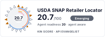 It updates itself when the score changes. Paste this where you link to your API docs:
<a href="https://apis.io/providers/usda-snap/"><img src="https://apis.io/badge/usda-snap/card.svg" alt="USDA SNAP Retailer Locator on APIs.io — Kin Score by API Evangelist"></a>Other styles, a README pill and a shields.io endpoint are on the badge page.
APIs 2
Individual APIs this provider publishes, each with its own machine-readable definition.
USDA SNAP Retailer Locator Retailers API
Query SNAP retailer location records.
USDA SNAP Retailer Locator Service API
Feature service and layer metadata.
Open Collections 3
Open, tool-agnostic API collections (OpenAPI-derived and Bruno).
SNAP Retailer Location Data Retailers API
OPEN COLLECTIONSNAP Retailer Location Data Retailers Service API
OPEN COLLECTIONUSDA SNAP Retailer Location Data API
OPEN COLLECTIONRate Limits 1
Documented rate limits and quota policies.
Usda Snap Rate Limits
RATE LIMITSSecurity Posture 1
Authentication, domain security, vulnerability disclosure, and trust-center signals.
Agentic Access 1
Recommended x-agentic-access execution contracts for AI agents.
Resources
Documentation 1
Reference material describing how the API behaves
Agent Surfaces 1
MCP servers, agent skills, and machine-readable catalogs
Access & Security 1
Authentication, authorization, and security posture
Operate 1
Status, limits, changes, and where to get help
Company 1
The organization behind the API
Other 1
Properties that don't map to a standard resource type
Source (apis.yml)
Work with this as data
Every provider here is available over the APIs.io API and to AI agents over MCP.