Home Providers MarineTraffic
MarineTraffic
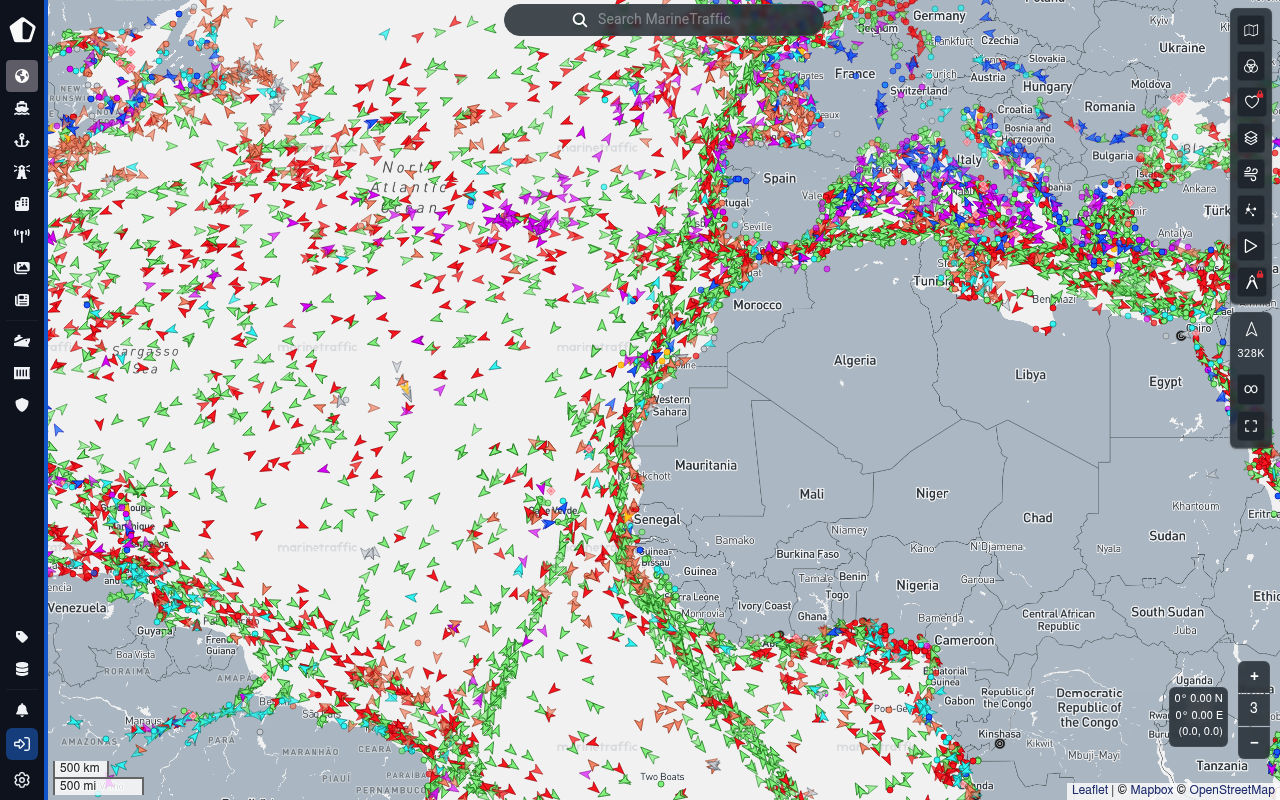
MarineTraffic is the leading maritime intelligence and AIS ship-tracking platform — now part of Kpler. The MarineTraffic AIS Data API exposes the same live + historical vessel positions, port calls, berth calls, vessel master data, voyage forecasts, predictive arrivals, port-congestion analytics, sea-lane routing, reverse geocoding, and fleet management endpoints that power the public marinetraffic.com map and the Kpler maritime data services. Data is sourced from 13,000+ terrestrial AIS receivers plus satellite AIS, served as REST/JSON (with CSV / XML / JSONO alternatives), authenticated via a per-key prepaid credit balance, and metered in credits per response row with per-service refresh-interval caching.
MarineTraffic publishes 14 API contracts indexed on the APIs.io network, including AIS API, Balances API, Fleets API, and 11 more. Tagged areas include AIS, Maritime, Vessel Tracking, Shipping, and Ports.
The MarineTraffic catalog on APIs.io includes 1 JSON-LD context and 2 Spectral governance rulesets.
MarineTraffic’s developer surface includes authentication, developer portal, documentation, API reference, support, sandbox, tooling, and 21 more developer resources.
9 published contracts20 Features7 Use Cases
On this page
Kin Score Standards 1
APIs 14
Open Collections 24
Pricing Plans 1
Rate Limits 1
FinOps 1
Features 20
Vocabularies 1
Spectral Rules 2
JSON Schema 5
Examples 3
Security Posture 2
Agentic Access 1
Use Cases 7
Integrations 5
Solutions 4
Resources 28
apis.yml
Business capabilities this provider's published APIs can perform, derived from its own
contracts. Browse all capabilities →
5 Operational Transparency
0 Create-or-Update Ergonomics
Composite quality — 40.5/100 · developing
Agent readiness — 30/100 · agent ready
Markets this provider is in provisional
The Kin Score Market layer reads a provider inside its market:
its position, and how deep its integrations go. Depth is only comparable within a position. Provisional and unweighted:
not part of the Kin Score or agent readiness.
Registered MCP server and declares compatibility are report only — not weighted .
Undeclared means we found nothing we can read, so there is no number: we never infer integrations.
Standards this provider implements or carries. De facto ones are profiled and measured by the API Commons ; formal ones come from the standards directory and are linked by the provider's own tags. The evidence column says how each claim was established — not that it was made.
tagged — the provider's own APIs.json carries the standard as a tag; implementation not verified
Individual APIs this provider publishes, each with its own machine-readable definition.
Scroll for all 14
Open, tool-agnostic API collections (OpenAPI-derived and Bruno).
Scroll for all 24
Published pricing tiers and plan structures.
Documented rate limits and quota policies.
Cost, billing, and metering signals for API financial operations.
Notable capabilities this provider offers.
AIS vessel positions (live + delayed) Vessel positions sourced from 13,000+ terrestrial AIS receivers and satellite AIS, accessible by single vessel, fleet, area of interest, port, or bounding box. Default delay 1 h...
Vessel historical track Replay a vessel's AIS track over a defined date / day window.
Port calls and berth calls Provider-detected arrival, departure, and berth-touch events per vessel and per port, with voyage duration and time-in-port.
Vessel master data Static AIS plus MarineTraffic-enriched fields — owner, manager, builder, class, build year, dimensions, deadweight, gross tonnage.
Vessel photographs Ship-photo retrieval via VD01.
Vessel search Search the ship database by identifier (IMO / MMSI / SHIP_ID / call sign) or by name.
Voyage forecasts Predictive destination, ETA, and route distance for a single vessel or a whole fleet (VI01).
Predictive destination areas Probability-ranked candidate destination ports for a vessel or fleet (VI04).
ETA to port Predictive ETA to a specific destination port (VI07).
Expected and predictive port arrivals Per-port arrival forecasts (VI02 / VI05) filtered by market, ship class, draught, and time window.
Port congestion analytics Anchorage time, in-port time, vessel and call counts per port / market / ship-class / ISO week (VI06).
Maritime routing Sea-lane-aware route + distance computation between origin and destination (VI03).
Reverse geocoding Coordinate-to-maritime-location resolution (port, anchorage, berth, terminal, custom area) (GI01).
Fleet management CRUD on power-user fleets — set, get, list, clear (PU01–PU05).
Account credit balance Live balance inspection via /exportcredits (free).
Passage plan import POST /import-passage-plan to ingest voyage plans for power-user fleets.
Multiple response protocols Per-call response format — json (default), jsono, xml, csv — via the protocol query parameter.
13,000+ terrestrial AIS receivers + satellite AIS Hybrid global coverage operated by Kpler / MarineTraffic.
Live NMEA streams (enterprise) Direct NMEA AIS streams available as an enterprise data product alongside the REST API.
Cloud database / bulk delivery (enterprise) Hosted cloud-database access and bulk CSV deliveries for high-volume customers.
Scroll for all 20
JSON-LD contexts and semantic vocabularies used across these APIs.
Spectral governance rulesets for linting and validating these APIs.
Standalone JSON Schema definitions for this provider's data models.
Example request and response payloads for these APIs.
Authentication, domain security, vulnerability disclosure, and trust-center signals.
Recommended x-agentic-access execution contracts for AI agents.
What developers build with this provider.
Scroll for all 7
Pre-built integrations with other platforms and tools.
Packaged solutions this provider offers.
Get Started 3
Portal, sign-up, and the first successful call
Documentation 5
Reference material describing how the API behaves
Agent Surfaces 1
MCP servers, agent skills, and machine-readable catalogs
Design & Contract 5
Pagination, idempotency, versioning, errors, and events
Build 2
SDKs, sample code, and the tooling you integrate with
Access & Security 2
Authentication, authorization, and security posture
Operate 3
Status, limits, changes, and where to get help
Commercial 3
Pricing, plans, and the legal terms of use
Company 3
The organization behind the API
Other 1
Properties that don't map to a standard resource type
Source (apis.yml)
aid: marine-traffic
url: https://raw.githubusercontent.com/api-evangelist/marine-traffic/refs/heads/main/apis.yml
apis:
- aid: marine-traffic:marine-traffic-ais-api-api
  name: MarineTraffic AIS API
  description: The AIS API API from MarineTraffic — 3 operation(s) for ais api.
  humanURL: https://servicedocs.marinetraffic.com/
  tags:
  - AIS API
  properties:
  - type: OpenAPI
    url: openapi/marine-traffic-ais-api-api-openapi.yml
  - type: Documentation
    url: https://servicedocs.marinetraffic.com/
  - type: JSONSchema
    url: json-schema/marine-traffic-vessel-position-schema.json
  - type: JSONLD
    url: json-ld/marine-traffic-context.jsonld
  - type: Examples
    url: examples/marine-traffic-vessel-position-example.json
  - type: JSONSchema
    url: json-schema/marine-traffic-port-call-schema.json
  - type: Examples
    url: examples/marine-traffic-port-call-example.json
  - type: JSONSchema
    url: json-schema/marine-traffic-vessel-master-schema.json
  - type: JSONSchema
    url: json-schema/marine-traffic-voyage-forecast-schema.json
  - type: Examples
    url: examples/marine-traffic-voyage-forecast-example.json
  - type: JSONSchema
    url: json-schema/marine-traffic-port-schema.json
- aid: marine-traffic:marine-traffic-balances-api
  name: MarineTraffic Balances API
  description: The Balances API from MarineTraffic — 1 operation(s) for balances.
  humanURL: https://servicedocs.marinetraffic.com/
  tags:
  - Balances
  properties:
  - type: OpenAPI
    url: openapi/marine-traffic-balances-api-openapi.yml
  - type: Documentation
    url: https://servicedocs.marinetraffic.com/
  - type: JSONSchema
    url: json-schema/marine-traffic-vessel-position-schema.json
  - type: JSONLD
    url: json-ld/marine-traffic-context.jsonld
  - type: Examples
    url: examples/marine-traffic-vessel-position-example.json
  - type: JSONSchema
    url: json-schema/marine-traffic-port-call-schema.json
  - type: Examples
    url: examples/marine-traffic-port-call-example.json
  - type: JSONSchema
    url: json-schema/marine-traffic-vessel-master-schema.json
  - type: JSONSchema
    url: json-schema/marine-traffic-voyage-forecast-schema.json
  - type: Examples
    url: examples/marine-traffic-voyage-forecast-example.json
  - type: JSONSchema
    url: json-schema/marine-traffic-port-schema.json
- aid: marine-traffic:marine-traffic-fleets-api
  name: MarineTraffic Fleets API
  description: The Fleets API from MarineTraffic — 4 operation(s) for fleets.
  humanURL: https://servicedocs.marinetraffic.com/
  tags:
  - Fleet
  tags_raw:
  - Fleets
  properties:
  - type: OpenAPI
    url: openapi/marine-traffic-fleets-api-openapi.yml
  - type: Documentation
    url: https://servicedocs.marinetraffic.com/
  - type: JSONSchema
    url: json-schema/marine-traffic-vessel-position-schema.json
  - type: JSONLD
    url: json-ld/marine-traffic-context.jsonld
  - type: Examples
    url: examples/marine-traffic-vessel-position-example.json
  - type: JSONSchema
    url: json-schema/marine-traffic-port-call-schema.json
  - type: Examples
    url: examples/marine-traffic-port-call-example.json
  - type: JSONSchema
    url: json-schema/marine-traffic-vessel-master-schema.json
  - type: JSONSchema
    url: json-schema/marine-traffic-voyage-forecast-schema.json
  - type: Examples
    url: examples/marine-traffic-voyage-forecast-example.json
  - type: JSONSchema
    url: json-schema/marine-traffic-port-schema.json
- aid: marine-traffic:marine-traffic-passage-plans-api
  name: MarineTraffic Passage Plans API
  description: The Passage Plans API from MarineTraffic — 1 operation(s) for passage plans.
  humanURL: https://servicedocs.marinetraffic.com/
  tags:
  - Passage Plans
  properties:
  - type: OpenAPI
    url: openapi/marine-traffic-passage-plans-api-openapi.yml
  - type: Documentation
    url: https://servicedocs.marinetraffic.com/
  - type: JSONSchema
    url: json-schema/marine-traffic-vessel-position-schema.json
  - type: JSONLD
    url: json-ld/marine-traffic-context.jsonld
  - type: Examples
    url: examples/marine-traffic-vessel-position-example.json
  - type: JSONSchema
    url: json-schema/marine-traffic-port-call-schema.json
  - type: Examples
    url: examples/marine-traffic-port-call-example.json
  - type: JSONSchema
    url: json-schema/marine-traffic-vessel-master-schema.json
  - type: JSONSchema
    url: json-schema/marine-traffic-voyage-forecast-schema.json
  - type: Examples
    url: examples/marine-traffic-voyage-forecast-example.json
  - type: JSONSchema
    url: json-schema/marine-traffic-port-schema.json
- aid: marine-traffic:marine-traffic-port-events-api
  name: MarineTraffic Port Events API
  description: The Port Events API from MarineTraffic — 2 operation(s) for port events.
  humanURL: https://servicedocs.marinetraffic.com/
  tags:
  - Port Events
  properties:
  - type: OpenAPI
    url: openapi/marine-traffic-port-events-api-openapi.yml
  - type: Documentation
    url: https://servicedocs.marinetraffic.com/
  - type: JSONSchema
    url: json-schema/marine-traffic-vessel-position-schema.json
  - type: JSONLD
    url: json-ld/marine-traffic-context.jsonld
  - type: Examples
    url: examples/marine-traffic-vessel-position-example.json
  - type: JSONSchema
    url: json-schema/marine-traffic-port-call-schema.json
  - type: Examples
    url: examples/marine-traffic-port-call-example.json
  - type: JSONSchema
    url: json-schema/marine-traffic-vessel-master-schema.json
  - type: JSONSchema
    url: json-schema/marine-traffic-voyage-forecast-schema.json
  - type: Examples
    url: examples/marine-traffic-voyage-forecast-example.json
  - type: JSONSchema
    url: json-schema/marine-traffic-port-schema.json
- aid: marine-traffic:marine-traffic-ports-information-api
  name: MarineTraffic Ports Information API
  description: The Ports Information API from MarineTraffic — 4 operation(s) for ports information.
  humanURL: https://servicedocs.marinetraffic.com/
  tags:
  - Ports Information
  properties:
  - type: OpenAPI
    url: openapi/marine-traffic-ports-information-api-openapi.yml
  - type: Documentation
    url: https://servicedocs.marinetraffic.com/
  - type: JSONSchema
    url: json-schema/marine-traffic-vessel-position-schema.json
  - type: JSONLD
    url: json-ld/marine-traffic-context.jsonld
  - type: Examples
    url: examples/marine-traffic-vessel-position-example.json
  - type: JSONSchema
    url: json-schema/marine-traffic-port-call-schema.json
  - type: Examples
    url: examples/marine-traffic-port-call-example.json
  - type: JSONSchema
    url: json-schema/marine-traffic-vessel-master-schema.json
  - type: JSONSchema
    url: json-schema/marine-traffic-voyage-forecast-schema.json
  - type: Examples
    url: examples/marine-traffic-voyage-forecast-example.json
  - type: JSONSchema
    url: json-schema/marine-traffic-port-schema.json
- aid: marine-traffic:marine-traffic-reverse-geocoding-api
  name: MarineTraffic Reverse Geocoding API
  description: The Reverse Geocoding API from MarineTraffic — 1 operation(s) for reverse geocoding.
  humanURL: https://servicedocs.marinetraffic.com/
  tags:
  - Reverse Geocoding
  properties:
  - type: OpenAPI
    url: openapi/marine-traffic-reverse-geocoding-api-openapi.yml
  - type: Documentation
    url: https://servicedocs.marinetraffic.com/
  - type: JSONSchema
    url: json-schema/marine-traffic-vessel-position-schema.json
  - type: JSONLD
    url: json-ld/marine-traffic-context.jsonld
  - type: Examples
    url: examples/marine-traffic-vessel-position-example.json
  - type: JSONSchema
    url: json-schema/marine-traffic-port-call-schema.json
  - type: Examples
    url: examples/marine-traffic-port-call-example.json
  - type: JSONSchema
    url: json-schema/marine-traffic-vessel-master-schema.json
  - type: JSONSchema
    url: json-schema/marine-traffic-voyage-forecast-schema.json
  - type: Examples
    url: examples/marine-traffic-voyage-forecast-example.json
  - type: JSONSchema
    url: json-schema/marine-traffic-port-schema.json
- aid: marine-traffic:marine-traffic-routing-information-api
  name: MarineTraffic Routing Information API
  description: The Routing Information API from MarineTraffic — 2 operation(s) for routing information.
  humanURL: https://servicedocs.marinetraffic.com/
  tags:
  - Routing Information
  properties:
  - type: OpenAPI
    url: openapi/marine-traffic-routing-information-api-openapi.yml
  - type: Documentation
    url: https://servicedocs.marinetraffic.com/
  - type: JSONSchema
    url: json-schema/marine-traffic-vessel-position-schema.json
  - type: JSONLD
    url: json-ld/marine-traffic-context.jsonld
  - type: Examples
    url: examples/marine-traffic-vessel-position-example.json
  - type: JSONSchema
    url: json-schema/marine-traffic-port-call-schema.json
  - type: Examples
    url: examples/marine-traffic-port-call-example.json
  - type: JSONSchema
    url: json-schema/marine-traffic-vessel-master-schema.json
  - type: JSONSchema
    url: json-schema/marine-traffic-voyage-forecast-schema.json
  - type: Examples
    url: examples/marine-traffic-voyage-forecast-example.json
  - type: JSONSchema
    url: json-schema/marine-traffic-port-schema.json
- aid: marine-traffic:marine-traffic-search-vessel-api
  name: MarineTraffic Search Vessel API
  description: The Search Vessel API from MarineTraffic — 2 operation(s) for search vessel.
  humanURL: https://servicedocs.marinetraffic.com/
  tags:
  - Search Vessel
  properties:
  - type: OpenAPI
    url: openapi/marine-traffic-search-vessel-api-openapi.yml
  - type: Documentation
    url: https://servicedocs.marinetraffic.com/
  - type: JSONSchema
    url: json-schema/marine-traffic-vessel-position-schema.json
  - type: JSONLD
    url: json-ld/marine-traffic-context.jsonld
  - type: Examples
    url: examples/marine-traffic-vessel-position-example.json
  - type: JSONSchema
    url: json-schema/marine-traffic-port-call-schema.json
  - type: Examples
    url: examples/marine-traffic-port-call-example.json
  - type: JSONSchema
    url: json-schema/marine-traffic-vessel-master-schema.json
  - type: JSONSchema
    url: json-schema/marine-traffic-voyage-forecast-schema.json
  - type: Examples
    url: examples/marine-traffic-voyage-forecast-example.json
  - type: JSONSchema
    url: json-schema/marine-traffic-port-schema.json
- aid: marine-traffic:marine-traffic-single-vessel-events-api
  name: MarineTraffic Single Vessel Events API
  description: The Single Vessel Events API from MarineTraffic — 3 operation(s) for single vessel events.
  humanURL: https://servicedocs.marinetraffic.com/
  tags:
  - Single Vessel Events
  properties:
  - type: OpenAPI
    url: openapi/marine-traffic-single-vessel-events-api-openapi.yml
  - type: Documentation
    url: https://servicedocs.marinetraffic.com/
  - type: JSONSchema
    url: json-schema/marine-traffic-vessel-position-schema.json
  - type: JSONLD
    url: json-ld/marine-traffic-context.jsonld
  - type: Examples
    url: examples/marine-traffic-vessel-position-example.json
  - type: JSONSchema
    url: json-schema/marine-traffic-port-call-schema.json
  - type: Examples
    url: examples/marine-traffic-port-call-example.json
  - type: JSONSchema
    url: json-schema/marine-traffic-vessel-master-schema.json
  - type: JSONSchema
    url: json-schema/marine-traffic-voyage-forecast-schema.json
  - type: Examples
    url: examples/marine-traffic-voyage-forecast-example.json
  - type: JSONSchema
    url: json-schema/marine-traffic-port-schema.json
- aid: marine-traffic:marine-traffic-vessel-historical-track-api
  name: MarineTraffic Vessel Historical Track API
  description: The Vessel Historical Track API from MarineTraffic — 2 operation(s) for vessel historical track.
  humanURL: https://servicedocs.marinetraffic.com/
  tags:
  - Vessel Historical Track
  properties:
  - type: OpenAPI
    url: openapi/marine-traffic-vessel-historical-track-api-openapi.yml
  - type: Documentation
    url: https://servicedocs.marinetraffic.com/
  - type: JSONSchema
    url: json-schema/marine-traffic-vessel-position-schema.json
  - type: JSONLD
    url: json-ld/marine-traffic-context.jsonld
  - type: Examples
    url: examples/marine-traffic-vessel-position-example.json
  - type: JSONSchema
    url: json-schema/marine-traffic-port-call-schema.json
  - type: Examples
    url: examples/marine-traffic-port-call-example.json
  - type: JSONSchema
    url: json-schema/marine-traffic-vessel-master-schema.json
  - type: JSONSchema
    url: json-schema/marine-traffic-voyage-forecast-schema.json
  - type: Examples
    url: examples/marine-traffic-voyage-forecast-example.json
  - type: JSONSchema
    url: json-schema/marine-traffic-port-schema.json
- aid: marine-traffic:marine-traffic-vessel-information-api
  name: MarineTraffic Vessel Information API
  description: The Vessel Information API from MarineTraffic — 2 operation(s) for vessel information.
  humanURL: https://servicedocs.marinetraffic.com/
  tags:
  - Vessel Information
  properties:
  - type: OpenAPI
    url: openapi/marine-traffic-vessel-information-api-openapi.yml
  - type: Documentation
    url: https://servicedocs.marinetraffic.com/
  - type: JSONSchema
    url: json-schema/marine-traffic-vessel-position-schema.json
  - type: JSONLD
    url: json-ld/marine-traffic-context.jsonld
  - type: Examples
    url: examples/marine-traffic-vessel-position-example.json
  - type: JSONSchema
    url: json-schema/marine-traffic-port-call-schema.json
  - type: Examples
    url: examples/marine-traffic-port-call-example.json
  - type: JSONSchema
    url: json-schema/marine-traffic-vessel-master-schema.json
  - type: JSONSchema
    url: json-schema/marine-traffic-voyage-forecast-schema.json
  - type: Examples
    url: examples/marine-traffic-voyage-forecast-example.json
  - type: JSONSchema
    url: json-schema/marine-traffic-port-schema.json
- aid: marine-traffic:marine-traffic-vessel-positions-legacy-api-api
  name: MarineTraffic Vessel Positions (Legacy API) API
  description: The Vessel Positions (Legacy API) API from MarineTraffic — 7 operation(s) for vessel positions (legacy api).
  humanURL: https://servicedocs.marinetraffic.com/
  tags:
  - Vessel Positions (Legacy API)
  properties:
  - type: OpenAPI
    url: openapi/marine-traffic-vessel-positions-legacy-api-api-openapi.yml
  - type: Documentation
    url: https://servicedocs.marinetraffic.com/
  - type: JSONSchema
    url: json-schema/marine-traffic-vessel-position-schema.json
  - type: JSONLD
    url: json-ld/marine-traffic-context.jsonld
  - type: Examples
    url: examples/marine-traffic-vessel-position-example.json
  - type: JSONSchema
    url: json-schema/marine-traffic-port-call-schema.json
  - type: Examples
    url: examples/marine-traffic-port-call-example.json
  - type: JSONSchema
    url: json-schema/marine-traffic-vessel-master-schema.json
  - type: JSONSchema
    url: json-schema/marine-traffic-voyage-forecast-schema.json
  - type: Examples
    url: examples/marine-traffic-voyage-forecast-example.json
  - type: JSONSchema
    url: json-schema/marine-traffic-port-schema.json
- aid: marine-traffic:marine-traffic-voyage-information-api
  name: MarineTraffic Voyage Information API
  description: The Voyage Information API from MarineTraffic — 5 operation(s) for voyage information.
  humanURL: https://servicedocs.marinetraffic.com/
  tags:
  - Voyage Information
  properties:
  - type: OpenAPI
    url: openapi/marine-traffic-voyage-information-api-openapi.yml
  - type: Documentation
    url: https://servicedocs.marinetraffic.com/
  - type: JSONSchema
    url: json-schema/marine-traffic-vessel-position-schema.json
  - type: JSONLD
    url: json-ld/marine-traffic-context.jsonld
  - type: Examples
    url: examples/marine-traffic-vessel-position-example.json
  - type: JSONSchema
    url: json-schema/marine-traffic-port-call-schema.json
  - type: Examples
    url: examples/marine-traffic-port-call-example.json
  - type: JSONSchema
    url: json-schema/marine-traffic-vessel-master-schema.json
  - type: JSONSchema
    url: json-schema/marine-traffic-voyage-forecast-schema.json
  - type: Examples
    url: examples/marine-traffic-voyage-forecast-example.json
  - type: JSONSchema
    url: json-schema/marine-traffic-port-schema.json
name: MarineTraffic
tags:
- AIS
- Maritime
- Vessel Tracking
- Shipping
- Ports
- Voyage Forecasting
- Geospatial
- Kpler
kind: contract
deliveryModel:
  model: saas
  open_source: false
  commercial: true
  callable_host: true
  label: Hosted service · you call their endpoint
  confidence: high
  source:
  - openapi
  - pricing
  generated: '2026-08-28'
  method: derived
accessModel:
  pricing: enterprise
  onboarding: unknown
  trial: false
  try_now: false
  public: false
  label: Enterprise
  confidence: medium
  source:
  - plans
  generated: '2026-07-22'
  method: derived
image: https://kinlane-images.s3.amazonaws.com/shared/apis-json/icons/marine-traffic.png
access: 3rd-Party
common:
- type: Website
  url: https://www.marinetraffic.com/
- type: Authentication
  url: authentication/marine-traffic-authentication.yml
- type: TermsOfService
  url: https://www.kpler.com/company/terms-of-use
- type: JSONSchema
  url: https://raw.githubusercontent.com/api-evangelist/marinetraffic/refs/heads/main/json-schema/marinetraffic-vessel-schema.json
- type: JSONLDContext
  url: https://raw.githubusercontent.com/api-evangelist/marinetraffic/refs/heads/main/json-ld/marinetraffic-context.jsonld
- type: CapabilityMap
  url: capabilities/marine-traffic-capability-edges.yml
  name: MarineTraffic Business Capability Map
- type: AgenticAccess
  url: agentic-access/marine-traffic-agentic-access.yml
- type: DomainSecurity
  url: security/marine-traffic-domain-security.yml
- url: https://www.marinetraffic.com/
  name: MarineTraffic
  type: Portal
- url: https://servicedocs.marinetraffic.com/
  name: AIS Data API Reference
  type: Documentation
- url: https://servicedocs.marinetraffic.com/
  name: API Reference
  type: APIReference
- url: https://www.kpler.com/product/maritime/data-services
  name: Kpler / MarineTraffic Maritime Data Services
  type: Portal
- url: https://support.marinetraffic.com/en/articles/9552659-api-services
  name: API Services — Common Problems and Solutions
  type: Support
- url: https://support.marinetraffic.com/en/articles/9552800-api-most-common-response-error-codes
  name: API Most Common Response Error Codes
  type: ErrorCodes
- url: https://support.marinetraffic.com/en/articles/9552860-what-kind-of-information-is-ais-transmitted
  name: What Kind of Information is AIS Transmitted
  type: Documentation
- url: https://support.marinetraffic.com/
  name: MarineTraffic Support Center
  type: Support
- url: https://www.marinetraffic.com/en/ais/home
  name: MarineTraffic Live Map
  type: Sandbox
- url: https://github.com/marinetraffic
  name: MarineTraffic on GitHub
  type: GitHubOrganization
- url: https://github.com/marinetraffic/mt-ais-toolbox
  name: mt-ais-toolbox — AIS Density Map Toolbox
  type: Tools
- url: https://www.linkedin.com/company/marinetraffic
  name: MarineTraffic on LinkedIn
  type: LinkedIn
- url: https://twitter.com/MarineTraffic
  name: MarineTraffic on Twitter / X
  type: Twitter
- url: openapi/_original/marine-traffic-openapi.yml
  type: OpenAPI
  name: Combined MarineTraffic AIS Data API (all surfaces)
- url: rules/marine-traffic-rules.yml
  type: SpectralRules
- url: vocabulary/marine-traffic-vocabulary.yml
  type: Vocabulary
- url: json-ld/marine-traffic-context.jsonld
  type: JSONLD
- url: plans/marine-traffic-plans-pricing.yml
  type: Plans
- url: rate-limits/marine-traffic-rate-limits.yml
  type: RateLimits
- url: finops/marine-traffic-finops.yml
  type: FinOps
- type: Features
  data:
  - name: AIS vessel positions (live + delayed)
    description: Vessel positions sourced from 13,000+ terrestrial AIS receivers and satellite AIS, accessible by single vessel,
      fleet, area of interest, port, or bounding box. Default delay 1 hour; real-time access via enterprise contract.
  - name: Vessel historical track
    description: Replay a vessel's AIS track over a defined date / day window.
  - name: Port calls and berth calls
    description: Provider-detected arrival, departure, and berth-touch events per vessel and per port, with voyage duration
      and time-in-port.
  - name: Vessel master data
    description: Static AIS plus MarineTraffic-enriched fields — owner, manager, builder, class, build year, dimensions, deadweight,
      gross tonnage.
  - name: Vessel photographs
    description: Ship-photo retrieval via VD01.
  - name: Vessel search
    description: Search the ship database by identifier (IMO / MMSI / SHIP_ID / call sign) or by name.
  - name: Voyage forecasts
    description: Predictive destination, ETA, and route distance for a single vessel or a whole fleet (VI01).
  - name: Predictive destination areas
    description: Probability-ranked candidate destination ports for a vessel or fleet (VI04).
  - name: ETA to port
    description: Predictive ETA to a specific destination port (VI07).
  - name: Expected and predictive port arrivals
    description: Per-port arrival forecasts (VI02 / VI05) filtered by market, ship class, draught, and time window.
  - name: Port congestion analytics
    description: Anchorage time, in-port time, vessel and call counts per port / market / ship-class / ISO week (VI06).
  - name: Maritime routing
    description: Sea-lane-aware route + distance computation between origin and destination (VI03).
  - name: Reverse geocoding
    description: Coordinate-to-maritime-location resolution (port, anchorage, berth, terminal, custom area) (GI01).
  - name: Fleet management
    description: CRUD on power-user fleets — set, get, list, clear (PU01–PU05).
  - name: Account credit balance
    description: Live balance inspection via /exportcredits (free).
  - name: Passage plan import
    description: POST /import-passage-plan to ingest voyage plans for power-user fleets.
  - name: Multiple response protocols
    description: Per-call response format — json (default), jsono, xml, csv — via the protocol query parameter.
  - name: 13,000+ terrestrial AIS receivers + satellite AIS
    description: Hybrid global coverage operated by Kpler / MarineTraffic.
  - name: Live NMEA streams (enterprise)
    description: Direct NMEA AIS streams available as an enterprise data product alongside the REST API.
  - name: Cloud database / bulk delivery (enterprise)
    description: Hosted cloud-database access and bulk CSV deliveries for high-volume customers.
  sources:
  - https://servicedocs.marinetraffic.com/
  - https://www.kpler.com/product/maritime/data-services
  updated: '2026-05-25'
- type: UseCases
  data:
  - name: Commodity trading and freight intelligence
    description: Power voyage analytics, tonnage tracking, and supply forecasting for commodity desks.
  - name: Port operations and logistics
    description: Anticipate berth demand, optimize pilotage and tug allocation, and reduce dwell.
  - name: Vessel tracking dashboards
    description: Build fleet dashboards and customer-facing tracking pages using PS04 + VI07.
  - name: Compliance and sanctions monitoring
    description: Detect dark fleet behavior, AIS gaps, port-call patterns, and sanctioned vessel touches.
  - name: Marine insurance underwriting
    description: Underwrite hull / P&I and route insurance with verified call histories and port-congestion data.
  - name: Government and coast guard situational awareness
    description: Feed maritime domain awareness systems with AIS, port-call, and routing context.
  - name: Carbon and ESG reporting
    description: Compute voyage-level CO2 estimates by combining VI03 routing + VD02 master data + AIS speed.
- type: Integrations
  data:
  - name: Kpler
    description: MarineTraffic is part of the Kpler maritime intelligence platform; AIS APIs sit alongside Kpler trade flow
      data.
  - name: Postman / API clients
    description: Standard REST + JSON; works directly in Postman, Insomnia, or any HTTP client.
  - name: GIS / mapping
    description: Output is lat/lon-tagged — integrates with QGIS, Mapbox, Leaflet, and Esri.
  - name: NMEA-compatible bridge systems
    description: Enterprise NMEA streams integrate with ECDIS, fleet-management software, and bridge electronics.
  - name: AIS density-map toolbox
    description: MarineTraffic publishes mt-ais-toolbox on GitHub for density-map generation from AIS data.
- type: Solutions
  data:
  - name: Self-serve REST API
    description: Public REST APIs metered against a prepaid credit balance — what this catalog covers.
  - name: NMEA live AIS streams
    description: Raw NMEA AIS for bridge-side and processing-pipeline customers (enterprise).
  - name: Cloud database access
    description: Hosted MarineTraffic database for SQL / analytics workloads (enterprise).
  - name: Custom data extracts
    description: Bespoke CSV / JSON delivery against custom queries (enterprise).
created: '2026-05-25T00:00:00.000Z'
modified: '2026-09-16'
position: Consuming
description: MarineTraffic is the leading maritime intelligence and AIS ship-tracking platform — now part of Kpler. The MarineTraffic
  AIS Data API exposes the same live + historical vessel positions, port calls, berth calls, vessel master data, voyage forecasts,
  predictive arrivals, port-congestion analytics, sea-lane routing, reverse geocoding, and fleet management endpoints that
  power the public marinetraffic.com map and the Kpler maritime data services. Data is sourced from 13,000+ terrestrial AIS
  receivers plus satellite AIS, served as REST/JSON (with CSV / XML / JSONO alternatives), authenticated via a per-key prepaid
  credit balance, and metered in credits per response row with per-service refresh-interval caching.
maintainers:
- FN: Kin Lane
  email: info@apievangelist.com
  X: apievangelist
  url: https://apievangelist.com
specificationVersion: '0.23'
Every provider here is available over the APIs.io API and to AI agents over MCP.
MCP server
One button, every client — Claude, Cursor, VS Code and the rest.
https://apis.io/mcp
Tools for providers
9 MCP tools reach this
find_providersBrowse and filter every provider in the catalog. get_provider_artifactsEvery artifact this provider publishes, grouped by type. get_provider_operationsEvery operation across all of their OpenAPIs — one call instead of parsing every spec. get_provider_toolsEvery MCP tool they ship, with the operation each wraps. get_provider_evidenceHow each part of their score was established. Free — the basis for a claim should not sit behind it. get_provider_ratingPRO — composite, band, trend and facet scores. apis_io_searchSTART HERE — APIs, providers and tags for one query, each with its total. resolveTurn a domain, URL or GitHub org into the provider it belongs to. find_cohortsEvery scored population of providers in the catalog.
All 92 tools →
Call it yourself
curl for this page
This provider
curl "https://apis.io/api/v1/providers/marine-traffic"
All providers
curl "https://apis.io/api/v1/providers?limit=25"
Every operation they expose
curl "https://apis.io/api/v1/providers/marine-traffic/operations?limit=25"
How their score was established
curl "https://apis.io/api/v1/providers/marine-traffic/evidence"
Discovery needs no key. Ratings and market analysis are Pro.
Get an API key
Free tier, no form to fill in. Signing in shares your email address with us — we
store it to create your key and to recognise you if you sign in with another
provider. See our Privacy Policy and
Terms .
A second provider on the same verified email joins the account you already have.
 Kin Score
How this is scored →
Kin Score
How this is scored →