State Service of Ukraine for Geodesy, Cartography and Cadastre
The State Service of Ukraine for Geodesy, Cartography and Cadastre (Ukrainian: Державна служба України з питань геодезії, картографії та кадастру) is a governmental agency responsible for maintaining the national geodetic network, cadastral mapping, and cartographic services. It provides public access to land registry data, geographic information system (GIS) resources, and official maps, supporting urban planning, property rights, and infrastructure development across Ukraine. The agency’s digital platforms offer APIs for accessing cadastral parcels, topographic maps, and coordinate transformation services, facilitating developers, researchers, and public institutions in integrating authoritative spatial data into their applications.
State Service of Ukraine for Geodesy, Cartography and Cadastre is profiled on the APIs.io network. Tagged areas include Government, Geospatial, GIS, Cadastral, and Mapping.
Kin Score
 Kin Score
How this is scored →
scored 2026-10-31 · rubric v0.25.0
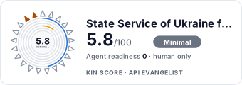 It updates itself when the score changes. Paste this where you link to your API docs:
<a href="https://apis.io/providers/state-service-of-ukraine-for-geodesy-cartography-and-cadastre/"><img src="https://apis.io/badge/state-service-of-ukraine-for-geodesy-cartography-and-cadastre/card.svg" alt="State Service of Ukraine for Geodesy, Cartography and Cadastre on APIs.io — Kin Score by API Evangelist"></a>Other styles, a README pill and a shields.io endpoint are on the badge page.
- Machine-Readable Contract +18 pts — api_specs includes an OpenAPI document
- MCP Server +12 pts — deployment.mode + probe verdict on the mcp/ manifest, not the pointer; an unprobed slug falls back to authorship
- Agentic Access Contract +10 pts — agentic_access artifact present (x-agentic-access), graded by author
- Machine-Readable Auth +10 pts — a served openid-configuration/oauth-authorization-server carrying `issuer` (served), else the securitySchemes class in the provider OpenAPIs — bound (mutualTLS, DPoP, Signature) > negotiable (oauth2 authorizationCode/clientCredentials, openIdConnect) > bearer (http bearer, apiKey)
- Idempotency +9 pts — OpenAPI mutating operations declare an idempotency key — a header, a request-body property, or a named de-duplication token whose own description says so (verified); else common[].type matches /idempoten/i (documented)
- A2A Agent Card +8 pts — a2a/
-a2a.yml manifest, graded on conformance.grade against A2A 1.0.0
- Contract Quality scores 0.0 — up to +25.0 composite points
- Developer Ergonomics scores 0.0 — up to +20.0 composite points
- Access Clarity scores 0.0 — up to +20.0 composite points
Security Posture 2
Authentication, domain security, vulnerability disclosure, and trust-center signals.
State Service Of Ukraine For Geodesy Cartography And Cadastre Domain Security
TLSv1.3 · HSTS · DMARC
SECURITYState Service Of Ukraine For Geodesy Cartography And Cadastre Vulnerability Disclosure
security.txt · contact published
SECURITYResources
Agent Surfaces 1
MCP servers, agent skills, and machine-readable catalogs
Access & Security 4
Authentication, authorization, and security posture
Company 2
The organization behind the API
Other 1
Properties that don't map to a standard resource type
Source (apis.yml)
Work with this as data
Every provider here is available over the APIs.io API and to AI agents over MCP.