CyberGIS Center for Advanced Digital & Spatial Studies
The CyberGIS Center for Advanced Digital & Spatial Studies, based at the University of Illinois, advances geospatial science by integrating high‑performance computing, big data analytics, and interdisciplinary research. It offers open‑source middleware, cloud‑based services, and educational resources to empower researchers, policymakers, and communities in tackling complex spatial challenges such as climate change, urban planning, and disaster response. Through collaborations with NSF and other partners, CyberGIS drives innovation in geospatial data processing, visualization, and collaborative analysis, fostering a sustainable future through shared cyberinfrastructure.
CyberGIS Center for Advanced Digital & Spatial Studies is profiled on the APIs.io network. Tagged areas include Company, Geospatial, HPC, Open-Source, and Research.
CyberGIS Center for Advanced Digital & Spatial Studies’ developer surface includes changelog and 9 more developer resources.
Kin Score
 Kin Score
How this is scored →
scored 2026-10-31 · rubric v0.25.0
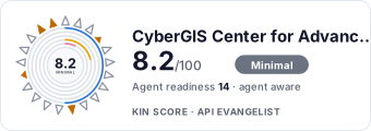 It updates itself when the score changes. Paste this where you link to your API docs:
<a href="https://apis.io/providers/cybergis-center-for-advanced-digital-spatial-studies/"><img src="https://apis.io/badge/cybergis-center-for-advanced-digital-spatial-studies/card.svg" alt="CyberGIS Center for Advanced Digital & Spatial Studies on APIs.io — Kin Score by API Evangelist"></a>Other styles, a README pill and a shields.io endpoint are on the badge page.
- Machine-Readable Contract +18 pts — api_specs includes an OpenAPI document
- MCP Server +12 pts — deployment.mode + probe verdict on the mcp/ manifest, not the pointer; an unprobed slug falls back to authorship
- Agentic Access Contract +10 pts — agentic_access artifact present (x-agentic-access), graded by author
- Idempotency +9 pts — OpenAPI mutating operations declare an idempotency key — a header, a request-body property, or a named de-duplication token whose own description says so (verified); else common[].type matches /idempoten/i (documented)
- A2A Agent Card +8 pts — a2a/
-a2a.yml manifest, graded on conformance.grade against A2A 1.0.0 - Stable Error Semantics +8 pts — OpenAPI $refs a shared error schema across 4xx/5xx responses (verified), else common[].type includes ErrorCatalog / ErrorCodes / DeclineCodes
- Contract Quality scores 0.0 — up to +25.0 composite points
- Access Clarity scores 0.0 — up to +20.0 composite points
- Developer Ergonomics scores 7.1 — up to +18.6 composite points
Security Posture 1
Authentication, domain security, vulnerability disclosure, and trust-center signals.
Resources
Agent Surfaces 1
MCP servers, agent skills, and machine-readable catalogs
Build 3
SDKs, sample code, and the tooling you integrate with
Access & Security 1
Authentication, authorization, and security posture
Operate 2
Status, limits, changes, and where to get help
Company 2
The organization behind the API
Other 1
Properties that don't map to a standard resource type
Source (apis.yml)
Work with this as data
Every provider here is available over the APIs.io API and to AI agents over MCP.