National Geospatial-Intelligence Agency
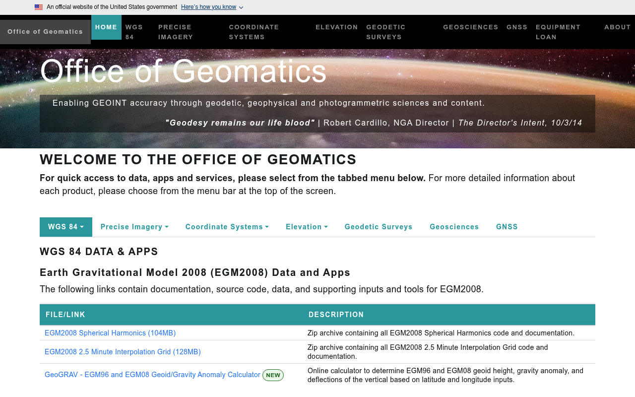
The National Geospatial-Intelligence Agency (NGA) is a combat support agency within the U.S. Department of Defense that provides geospatial intelligence in support of national security. Through its Office of Geomatics, NGA publishes the Earth-Info portal, which exposes a REST API in OpenAPI format for downloading GPS ephemeris products, Earth Orientation Parameter Predictions (EOPP), Navdata clock state files, and short-term orbit prediction products. NGA also maintains the WGS 84 reference frame, EGM2008 gravitational model, and the GEOTRANS coordinate conversion tool.
National Geospatial-Intelligence Agency publishes 4 APIs on the APIs.io network, including Clock API, EOPP API, Ephemeris API, and 1 more. Tagged areas include Federal Government, Geospatial, Intelligence, Defense, and Geomatics.
National Geospatial-Intelligence Agency’s developer surface includes developer portal and 7 more developer resources.
Kin Score
 Kin Score
How this is scored →
Kin Score
How this is scored →scored 2026-07-28 · rubric v0.6
APIs 4
Individual APIs this provider publishes, each with its own machine-readable definition.
National Geospatial-Intelligence Agency Clock API
Navdata clock state files.
National Geospatial-Intelligence Agency EOPP API
Earth Orientation Parameter Predictions in multiple formats.
National Geospatial-Intelligence Agency Ephemeris API
GPS ephemeris products, including Center of Mass and Antenna Phase Center variants.
National Geospatial-Intelligence Agency Orbit API
Short-term orbit prediction products.
Open Collections 1
Open, tool-agnostic API collections (OpenAPI-derived and Bruno).
NGA Earth-Info REST API
OPEN COLLECTIONPricing Plans 1
Published pricing tiers and plan structures.
Rate Limits 1
Documented rate limits and quota policies.
FinOps 1
Cost, billing, and metering signals for API financial operations.
Security Posture 1
Authentication, domain security, vulnerability disclosure, and trust-center signals.
Agentic Access 1
Recommended x-agentic-access execution contracts for AI agents.
Resources
Get Started 1
Portal, sign-up, and the first successful call
Agent Surfaces 1
MCP servers, agent skills, and machine-readable catalogs
Build 1
SDKs, sample code, and the tooling you integrate with
Access & Security 1
Authentication, authorization, and security posture
Operate 1
Status, limits, changes, and where to get help
Company 2
The organization behind the API
Other 1
Properties that don't map to a standard resource type